Reference · Orbit globe · elements as of
Where are our satellites now?
See where the EU's payloads, or any owner's, are now, which ground stations on the critical infrastructure map see them, and what orbits beside them.
Legilux
Published by 303 Overwatch A.S.B.L from the public satellite catalogue and public element sets so that EU operators can see their fleet in one view they can send. Accredited by the Luxembourg Ministry of National Education.
GP
Positions from CelesTrak GP element sets built on . Orbital element sets from CelesTrak (celestrak.org), from US Space Force data published on Space-Track.org. Owners as the CelesTrak satellite catalogue records them. Not for operational decisions.
The fleet now
As of
- Payloads drawn560operational, EU group
- In view of a station now144above 10°
- Ground stations45from the map, built 2026-10-02
- Positions at08:54:24UTC, when the element sets were built
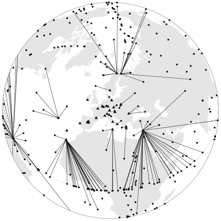
- Payload in this set, 560
- Ground station from the map, 45
- In view above 10°, a line to the station that sees it highest, 144 lines
The satellites drawn
Loading the satellites
Ground stations
The 45 ground stations of the critical infrastructure map, built 2026-10-02, with how many of the payloads drawn each sees above 10°.
What this is not
SGP4 on public mean element sets up to a day or two old is accurate to about a kilometre at the epoch and less with every day after it: not an ephemeris and not a measurement.
A payload counts as in view above a flat 10° at the station, with no refraction and no terrain. A separation shown in the geostationary belt is at one moment, from public elements, and is not a conjunction assessment. Not for operational decisions.
Annex I(11)
If you operate satellites or ground stations in the EU
If you run a ground station or teleport in the EU, NIS2 names you in Annex I, sector 11, and asks you to assess whether your security measures work; 303 Overwatch runs a no-fee working session that helps you stand up your own exercise capability to do it.
Talk to the Center of Excellence